4.3.1.2. Coordinate systems
In IRM a Coordinate System is an object that represents a coordinate system used in one or more Areas.
Wikipedia: “In geometry, a coordinate system is a system which uses one or more numbers, or coordinates, to uniquely determine the position of a point or other geometric element on a manifold such as Euclidean space.”
When defined, an Area must be assigned a coordinate system, which may or may not be the same coordinate system used by other Areas.
For example, it would normally make sense for all floors of a building to share a single coordinate system, as the orientation, scale, and positioning of all the building’s floor plans would normally be comparable to each other. However, floors from a different building may very well use a different coordinate system, as that building may be oriented differently and does not share the exact same space as another building.
Note: IRM does not impose any of these restrictions, but structuring the data logically is helpful when defining Areas.
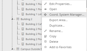
The units of a Coordinate System can be either Metric (Meters and Centimeters), Imperial (feet and Inches) or Geospatial (Lat/Long or UTMxy).
A geo-spatial coordinate system is one that has a reference point set with x/y and latitude/longitude values that correspond to each other, plus a rotation angle.
If an Area uses a geo-enabled coordinate system, IRM can identify the latitude and longitude of any position within the area.
IMPORTANT: If two Areas use the same Coordinate System, either geo-enabled or not, it is possible to display both Areas within a single Canvas window in IRM.
This ability allows the Areas to be independently defined yet still be visualized as a single drawing within the shared canvas space.
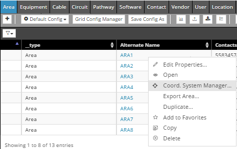
An important feature in IRM that enables managing Coordinate Systems is the Coordinate System Manager dialog:
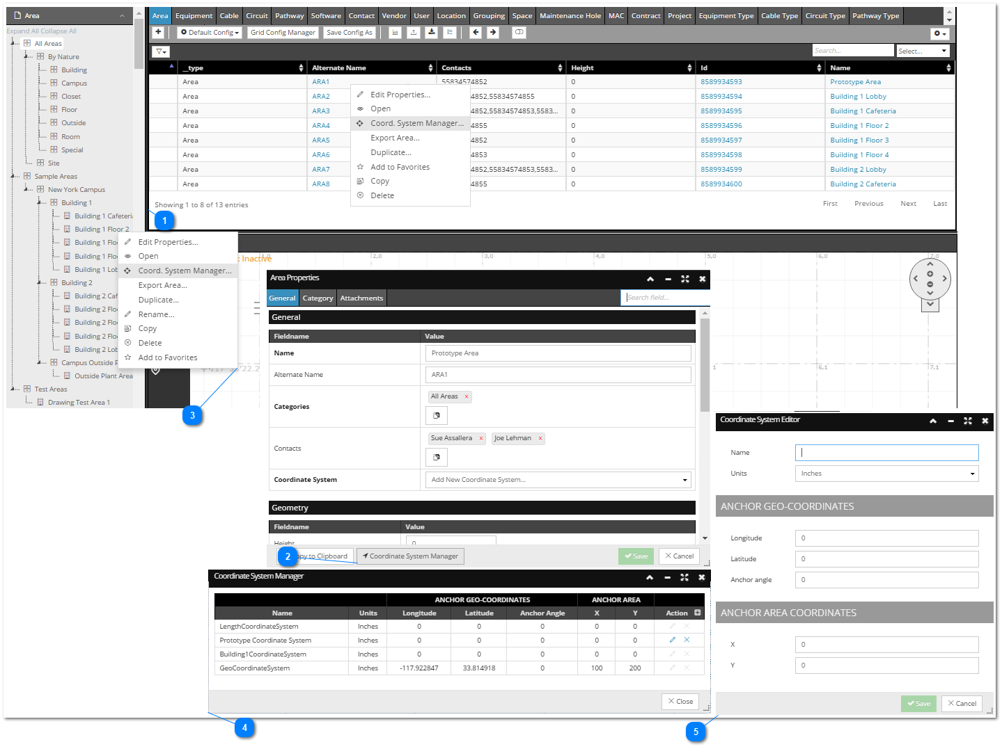
The first 3 steps display the possible ways of accessing the Coordinate Systems Manager dialog:
"Coordinate System Editor" dialog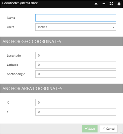 This dialog can be accessed clicking on the Edit action button in the Coordinate System Manager dialog, or selecting Add new Coordinate System from the drop-down menu in the Area Properties dialog (see the following topic for this use case - Create an Area). It displays the property fields that defines a Coordinate System and enables editing them and saving the changes.
|