Map background
A Map background is automatically displayed when the Area has been defined to use geo-coordinate system and has a geo datum defined. This will automatically display the relevant geospatial map when opening the Area in the Design World.
In addition to the basic background image capability described in the previous topic, IRM provides the ability to show pannable and zoomable maps as the background in the Design World canvas area. This more advanced feature is mostly intended for representation of smaller-scale outside plant Areas, up to metropolitan areas.
Note for AriGapped on-premises IRM deployments: The mapping capability is provided via OpenStreetMaps software and data and for on-premises deployments requires a separate AirGapped mapserver. See the Admin Guide for additional information about how to configure a map server for on-premises deployments.
Note: The Global Console has similar mapping capabilities, including both static maps and pannable and zoomable maps.
A map background is supported for Areas that use geo-enabled Coordinate Systems, which the Web Client aligns coordinates with coordinates in the map.
The user is able to control map visibility via a Design World toolbar toggle button:
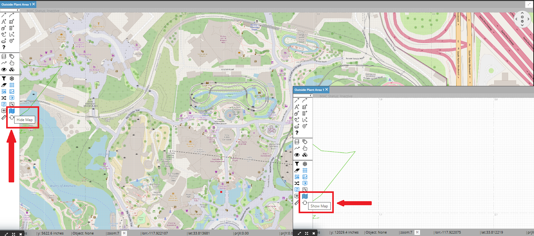
However, pressing that does not change whether the map is shown initially when the Area is opened. This is set by a specific Area data field - Show Map By Default.
IRM has three other features related to geo coordinates:
-
geo coordinates are displayed in the status bar on the bottom of the Design World, in addition to cartesian coordinates
-
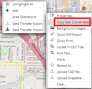
the geo coordinates of the anchor point of an Area can be copied to the clipboard via an Area context menu option. Note that this option is enabled only for the Areas that have the Geo Map set as enabled (show map)
-
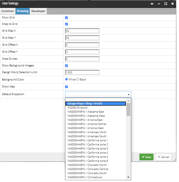
there is a User Setting which enables selection of the default geo projection to display coordinates in. This setting is Default Projection, which is in the Drawing tab