4.3.1.2. Coordinate systems
In IRM a Coordinate System is an object that represents a coordinate system used in one or more Areas.
Wikipedia: “In geometry, a coordinate system is a system which uses one or more numbers, or coordinates, to uniquely determine the position of a point or other geometric element on a manifold such as Euclidean space.”
When defined, an Area must be assigned a coordinate system, which may or may not be the same coordinate system used by other Areas.
For example, it would normally make sense for all floors of a building to share a single coordinate system, as the orientation, scale, and positioning of all the building’s floor plans would normally be comparable to each other. However, floors from a different building may very well use a different coordinate system, as that building may be oriented differently and does not share the exact same space as another building.
Note: IRM does not impose any of these restrictions, but structuring the data logically is helpful when defining Areas.
The units of a Coordinate System can be either Metric (Meters and Centimeters), Imperial (feet and Inches) or Geospatial (Lat/Long or UTMxy).
A geo-spatial coordinate system is one that has a reference point set with x/y and latitude/longitude values that correspond to each other, plus a rotation angle.
If an Area uses a geo-enabled coordinate system, IRM can identify the latitude and longitude of any position within the area.
IMPORTANT: If two Areas use the same Coordinate System, either geo-enabled or not, it is possible to display both Areas within a single Canvas window in IRM.
This ability allows the Areas to be independently defined yet still be visualized as a single drawing within the shared canvas space.
An important feature in IRM that enables managing Coordinate Systems is the Coordinate System Manager dialog:
The first 3 steps display the possible ways of accessing the Coordinate Systems Manager dialog:
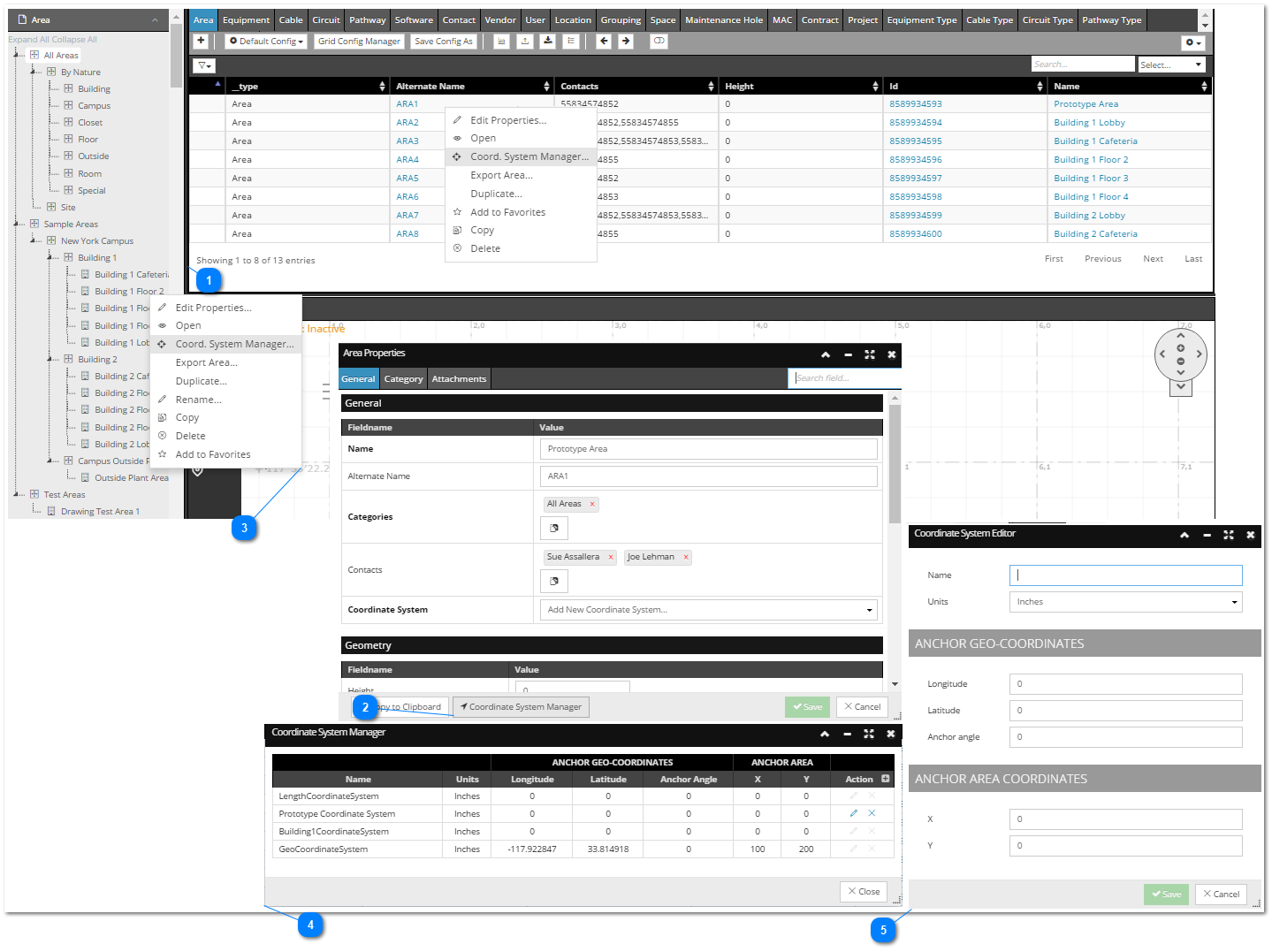
 Select "Coordinate System Manager..." option from an Area object's context menu in Area tab in Object Grid |
|
 Click on the "Coordinate System Manager" button in the bottom of the "Area Properties" dialog |
|
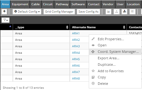
 Select the "Coordinate System Manager..." option from an Area object's context menu in C&T tree |
|
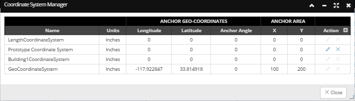
 "Coordinate System Manager" dialogThis dialog displays a grid that lists all existing Coordinate Systems, with additional Action buttons that enable managing them:
 - Add - Add action button enables creating a new Coordinate System (See step 5).
 - Edit - Edit action button enables editing a Coordinate System. It is enabled only for Coordinate Systems that are not currently referenced by any Area (Also, the Length Coordinate System is special and is always disabled for editing or removing). Click on the edit action button opens the Coordinate Systems Editor dialog (see the step 5) displaying different properties that can be edited. After necessary changes are made and saved the changed Coordinate System is displayed in the main grid.
 - Delete action button enables removing a Coordinate System. It is enabled only for Coordinate Systems that are not currently referenced by any Area. Click on it opens a confirmation dialog, after which the Coordinate System is removed from the main grid (if removal is confirmed). |
|
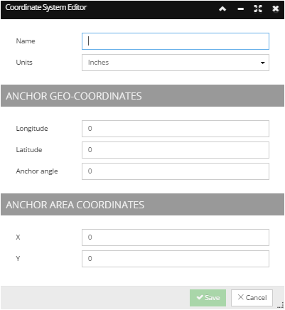
 "Coordinate System Editor" dialogThis dialog can be accessed clicking on the Edit action button in the Coordinate System Manager dialog, or selecting Add new Coordinate System from the drop-down menu in the Area Properties dialog (see the following topic for this use case - Create an Area). It displays the property fields that defines a Coordinate System and enables editing them and saving the changes. |
|