To further extend the feature, IRM supplies the following functionalities when importing Shapefiles into a Design World Area:
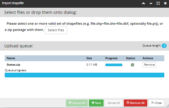
Ability to upload a single zip file instead of individual shapefile component files, which is useful in cases where the user wants to import multiple shapefile "layers" at once. The ability to upload individual shapefile component files is also supported, as that may still be more convenient in some cases.
Ability to properly geo-locate the shapefile, assuming the target Area has a geo-enabled Coordinate System. Part of the reason and motivation for this is that the current CAD file import protocol includes the client specifying the target Coordinate System, and shapefile upload provides the same.
For Shapefiles that contain coordinates in a system other than that of the target Area, including shapefiles that have latitude/longitude coordinates, IRM transforms the coordinates as indicated by the Coordinate System EPSG Code of the target Coordinate System.
To accommodate these requirements, IRM provides the shapefiles import wizard dialog.
The first step of the wizard enables the user to upload files without additional settings.
Notice that after successful upload of all files, the 'Upload All' button is disabled. In case of errors during upload file process, or in case all files haven't successfully uploaded, appropriate error messages appear in the top part of the dialog.
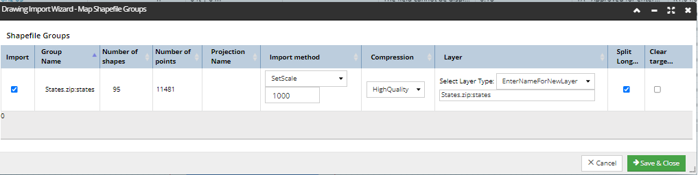
After successfully loading the files, the next step of the wizard displays information about the shapefile groups in the grid, as a result of IRM data analysis. The displayed parameters are the recommended default parameters for all fields. In this grid, the user can change the selection of groups of shapefiles to import or change the import settings.
Additional details about parameters that can be set by the user within this data grid:
the Import checkbox field allows exclusion of a group from the import
Projection Name - displayed only if a .prj file is being imported
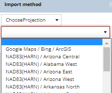
The drop-down menu under the Import method column enables selecting between one of the following options:
Use Source Projection - available only if a .prj file is being imported
Choose Projection - requires selecting an IRM GIS System
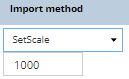
Set Scale - requires specifying a scale value
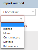
Choose Unit - requires selection of a unit:
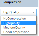
Under the Compression column, the user can select one of the available compression modes:
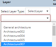
Under the Layer column, the user can either select an existing Layer from the drop-down list;
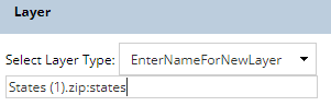
or specify a new Layer:
Split Long Lines checkbox option, which allows splitting lines with a large number of points
Clear target layer checkbox option clears the selected layer before starting the import operation.
After viewing or changing the settings, the user can click the Save & Close button, which sets the parameters for the shapefile groups and starts the import process.
Additional caveats and limitations to be aware of:
There is additional validation for few changed fields and showing errors under field. If there are errors the Save & Close button is not available.
Upload All button is disabled until files are loaded in the Import shapefile dialog.
inside the Shapefile Groups Mapper dialog, in case the grid is empty, the Save & Close button is not active
There is additional validation to the added files in the Import shapefile dialog when:
the user hasn't uploaded any files yet
some files are missing in the shapefile set
Generally, within the Import Shapefile Wizard dialog, the Next button is disabled when some errors are found.